In the dynamic City of technological progress, Lidar sensors, or Light Detection and Ranging sensors, have emerged as pivotal tools in the development of smart cities. These sophisticated sensors utilize laser light to gauge distances and construct intricate three-dimensional maps, providing a trove of data that is reshaping urban planning, traffic management, and public safety on a global scale.
Among the many applications of Lidar sensors in smart cities, their integration into autonomous vehicles stands out as particularly impactful. Self-driving cars heavily rely on Lidar technology to navigate their surroundings with precision and safety. By emitting laser pulses and measuring the time it takes for the light to return, Lidar sensors generate real-time data crucial for autonomous vehicles to navigate obstacles, maintain safe distances, and adhere to traffic regulations. As cities worldwide embrace autonomous vehicles in their public transportation systems, Lidar technology is poised to play a pivotal role in ensuring the safety and efficiency of these fleets.
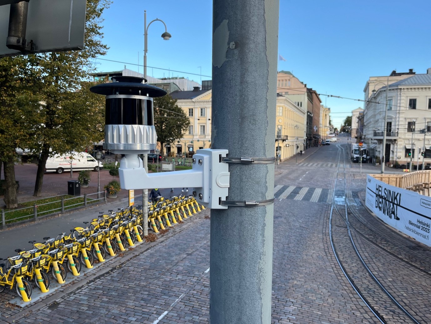
In a notable example, the Helsinki pilot, in collaboration with the companies, has implemented Lidar sensors in its city center, specifically in the Esplanadi streets and pathways. Three Lidar radars have been strategically placed to collect data on moving vehicles, bicycles, electric scooters, and pedestrians. This real-time information is gathered and analyzed with utmost respect for privacy. The Lidar data analysis in this initiative aims to explore the potential of extracting detailed information about movement patterns in the area. This data, derived from advanced Lidar sensors, could be instrumental in enhancing the safety and appeal of the region.
The Lidar sensors strategically placed in the area combine their data to generate precise representations of factors such as traffic flow, potential hazards, and the volume of pedestrians and light traffic. These sensors create detailed three-dimensional models of the environment, offering a comprehensive understanding of how different factors, including seasons, events, and traffic arrangements, influence pedestrian and light traffic patterns.
The data collected through Lidar sensors not only aids in understanding current scenarios but also opens doors for future improvements. The Helsinki project aims to explore whether analyzing this data can enhance the safety of commuters, improve cycling efficiency, and boost the overall attractiveness of the area for pedestrians. Importantly, the project focuses on anonymous behavior analysis rather than individual tracking, respecting privacy concerns.